

What Israel Reveals Off the Main Path
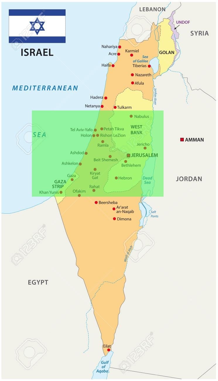
Israel is a very small country. It stretches for less than 500 kilometers from north to south and for a maximum of 130 kilometers from west to east. Yet the territory is immense in its historical and natural wealth. Among the offbeat places in Israel, some are hidden just beyond a hill or across a bridge—where the landscape suddenly shifts and tells a different story.
In this article, we will introduce you to some secret places in Israel, lesser-known spots that are well worth a visit. These places are sometimes forgotten in tourist books or left out of itineraries that are too well-marked by travel agencies. However, they deserve just as much attention. Accessibility is sometimes challenging via local transportation, and reaching them on your own may take extra time, but the experience is undoubtedly rewarding.
So don’t hesitate to ask an Israeli tour guide to show you the way and explain the way.

Must-see and secret places in Northern Israel

1. Manara’s cliff
Location : Northern Israel – Upper Galilee – Border with Lebanon.
Nearest cities : Kiryat Shmona (2 km) Safed (30 km south)

High above the Galilee, where the land begins to lean toward the border, Manara stands quiet — except for the wind. The cliff, steep and pale, holds Israel’s highest cable car. It stretches from Kiryat Shmona all the way up to the Naftali Mountains. A short ride, but the views shift quickly. Hills, then fields, then Lebanon just across the way. The Hula Valley spreads below, with Mount Hermon watching from a distance.
For some, it’s a lookout. For others, it’s a playground. Paragliding, carting, a toboggan track that weaves down more than a kilometer — fast, loud, slightly chaotic. There’s abseiling too. Zip-lines cut across the air. No one’s forced to try, but the mountain doesn’t exactly whisper.
2. Gamla Nature Reserve
Location : Northern Israel – Golan Heights – Border with Syria.
Nearest cities : Moshav Ramot (30 km east) Katzrin (17 km north) Tiberias (32 km west)

Tucked into the northern Golan, the Gamla Nature Reserve feels distant — not just in location, but in time. Birds rule the sky here. Vultures, eagles, gliding quietly above the cliffs. A narrow path climbs upward, ending at a ledge where you can watch them float, far above the Sea of Galilee. It’s not a performance. Just movement, on their terms.
There’s a waterfall, too. The tallest in the country. It falls hard, straight into a wide canyon, surrounded by rock and wind. No signs, no fences — just the sound of water hitting deep.
But the silence holds something heavier. Mount Gamla carries history. Long ago, in the early years of the Christian era, the Romans laid siege to a village here. Few survived. Most of the inhabitants chose to leap rather than surrender. The land remembers.
3. Rosh Pina
Location : Northern Israel – Upper Galilee.
Nearest city : Safed (2 km)

In northern Israel, there is a magical town with picturesque cobblestone streets. Founded by a group of religious immigrants and financed by Baron Rothschild in the 1800s, Rosh Pina has become a hidden gem.
Up the mountain, the main road leads to the original neighborhood and at the top of the hill is the Nimrod Lookout, which offers a monumental view of the Houla Valley, the Golan Mountains and of course, Mount Hermon and the Druze village, Majdal Shams. The Baron Rothschild Gardens, built at the end of the 19th century and designed by the same creators as the gardens of Versailles, are located nearby and are worth a visit. Another feature of Rosh Pina are the “Zimmers” or “Tsimmers”, peaceful residential rental properties located in the middle of nature and featuring swimming pools and saunas.
4. Mount Tabor
Location : Northern Israel – Lower Galilee.
Nearest cities : Haifa (54 km west) Tiberias (32 km west)

It rises gently from the plain — round, solitary. Mount Tabor. For many, it’s more than just a hill. According to the Gospels, this is where the transfiguration happened. A moment, brief but vivid, when Jesus revealed his divine form to three of his disciples: Peter, James, and John.
At the summit stands a Franciscan monastery, built on the remains of a much older Byzantine church. The stones carry weight, even for those who don’t come with faith.
The views alone are worth the climb. The Jezreel plain stretches wide, uninterrupted. In spring, it changes completely — thick lines of wildflowers sweeping across the hills. You can drive up, of course. But walking the forested path feels closer to the place. Slower. More honest.
5. Achziv Beach
Location : Northwest coast of Israel – Galilee.
Nearest cities : Akko (15 km south) Nahariya (5 km west)

North of Akko, about 15 kilometers, the coastline changes. Cliffs appear. The sound shifts. Near Nahariya, a quieter stretch of beach opens up — not wide, but broken into small coves. Pools of seawater sit between the rocks, shaped by time more than by people.
This is a nature reserve, and parts of it feel untouched. Out just a little way, a few small islands dot the water. They belong to birds now. The Islands of Achziv Beach fill with seagulls in the summer — scattered groups, calling above the waves.
That same season, sea turtles come in. Quietly. They drag themselves up the sand to lay their eggs, then vanish again into the sea. Most people never see it happen, but the shore remembers.
6. Montfort Castle
Location : Northern Israel – Border with Lebanon.
Nearest city : Nahariya (20 km west)

Perched on a narrow ridge in the Galilee, Montfort Castle is more ruin than fortress now. But the story still clings to the stones. Built in the late 12th century by German crusaders, it didn’t last long. In 1271, Mamluk forces stormed the hilltop, tore it down, and left it broken.
What remains is scattered — walls, arches, a trace of what stood here. But the climb is worth it. From the top, the view opens wide. Hills roll out in every direction. A quiet kind of vastness.
To get there, the trail begins in the small village of Hila, not far from the Nahal Kziv stream. The walk is part of the experience. Today, it’s a place hikers come back to — not just for the ruins, but for the path that runs alongside the water, shaded and calm.
7. Arbel cliff
Location : Northern Israel – Galilee.
Nearest city : Tiberias (9 km east)

The cliff of Arbel dominates the lake of Tiberias. It is the central point of a natural park rich in flora and fauna. You can visit an ancient fortress and the remains of an impressive troglodytic village from the time of Herod with its ancient synagogue. It was in these caves that the Jews who fought against the Greeks and Romans hid.
These places were inhabited by the Druze until the 18th century and are nowadays easily accessible via hiking trails.
8. Caesarea National Park
Location : Northwest coast of Israel.
Nearest cities : Kiryat Shmona (10 km west) Safed (47 km south)

Halfway between Tel Aviv and Haifa, right on the Mediterranean coast, the city of Caesarea stretches along the shore. Quiet today, yet deeply layered with history. Some of it dates back to the time of Herod, in the first century BC. The stones still hold the outline of another era.
Among the most striking attractions in north Israel, its massive amphitheater remains in use. In summer, it becomes a concert venue. Music fills the space where voices once echoed in Latin and Greek.
Near the ancient harbor, cafés lean toward the water. Evenings slow down naturally, a drink, maybe dinner, while the sun sinks into the sea. Just beyond, the sand opens wide again. Caesarea Aqueduct Beach, broad, clean, and often nearly empty. The kind of place people return to without needing a reason.
9. Banias Falls Park
Location : Northern Israel – Golan Heights – Border with Lebanon.
Nearest city : Kiryat Shmona (14 km west) Nahariya (91 km west)

Halfway between the Houla Valley and the mountainous region of Mount Hermon ; we discover one of the largest waterfalls in Israel (10 meters high). It is a must for all tourists visiting the Golan. There are many possibilities for excursions and it is advisable to stay a few days to better appreciate the region.
For those who have only one day, the park of Banias is not to be missed under any pretext. You can get there from the source of the stream or directly from the cliff. A suspended path connects the two places. On your way, you will discover an ancient Roman bridge, an old hot water pool, an old windmill still in activity as well as the ruins of the crusaders’ passage.
10. Rosh Hanikra caves
Location : North-western Israel- Golan Heights – Border with Lebanon.
Nearest city : Nahariya (10 km south)

Rosh Hanikra is a geological formation on the border between Israel and Lebanon in the western Galilee. It is a white chalk cliff that opens into spectacular caves. The caves of Rosh HaNikra are tunnels formed by the action of the sea and the waves that crash into the rocks.
A 200 meter long path has been built through the sea caves. On a 60 degree slope, a cable car was built to take visitors from the top of the cliff to the tunnels. The British, wishing to build a road from Haifa to Tripoli, dug a path through the cliffs with a special tunnel for the railway. You can rent bicycles and enjoy a nice ride along beautiful coves with a breathtaking view of the bay and three small islands that are home to a variety of water birds.
11. The Circassian village of Kfar Kama
Location : Northern Israel – Lower Galilee.
Nearest city : Tiberias ( 25 km east)

The Circassians came from the Caucasus — mountains, deep forests, long winters. They lived there for centuries. Then, in the 19th century, came war. Russia pushed south, and the Circassians were forced out. Over a million died. The rest scattered. The Ottoman Empire opened its doors.
Some settled in what is now northern Israel. Kfar Kama. Around 3,000 people today. A small village, but the memory runs deep. There’s a museum here, dedicated to their culture. Worth a stop, but really, it’s the streets that carry it best. Narrow, quiet, lined with stone houses that haven’t changed much.
A few places still serve food from the old country — dishes with names that don’t translate easily, flavors that feel distant but familiar. The kind of visit that leaves a trace without trying to impress.
12. Mt. Guilboa
Location : Northern Israel – Lower Galilee.
Nearest cities : Afoula (13 km west) Nazareth ( 22 km north)

At the edge of Samaria’s northeastern tip, Mount Gilboa rises slowly — not dramatic, but steady. From the top, the Jordan River runs quietly in the distance. Below, the Jezreel Valley spreads out, soft and wide.
The trails here wind gently through brush and stone. Some are meant for hikers, others for bikes. The most well-known route is the Gilboa Scenic Road — a 27-kilometer stretch that follows the ridge. It’s not about speed. There are stops along the way. Terraces with space to sit, eat, or just look out and say nothing.
The view changes as you move. That’s part of the appeal. Open, slow, unforced.
13. Tabgha – Church of the Multiplication and Capernaum
Location : Northern Israel – Lower Galilee.
Nearest city : Tiberias (13 km south)

One of the sacred places of Christian tradition. Tabgha — a quiet stretch of shoreline on the north side of the Sea of Galilee, also known as Lake Tiberias. Peaceful, still. It was here, the Gospels say, that Christ fed a crowd with a few loaves and fishes. A moment remembered in stone.
The church on the site — Benedictine, built in the fourth century — lay hidden for a long time. Archaeologists uncovered it only decades ago. Restored now, calm inside, with mosaics of fish and bread worked into the floor. Simple images, heavy with meaning.
Just three kilometers from there, the village of Capernaum. A fishing town, mentioned often in the New Testament. Jesus lived here, as did at least five of his disciples. Today, visitors come to see the St. Peter’s Basilica, recently built over the remains of a sixth-century Byzantine church. Beneath it lies the ”insula sacra” — believed to be the house of St. Peter. A sacred layer beneath the modern one.
14. The waterfalls of El-Al river
Location : Northern Israel – Golan – East of Lake Tiberias.
Nearest cities : Ramot (23 km west ) Safed (51 km north)

Down in the southern Golan, Nahal El Al winds its way through rock and brush. The river isn’t wide, but it moves with purpose. Over time, the water has carved out deep channels, cutting through stone until it drops — one fall dark, the other pale. Locals call them the “Black Waterfall” and the “White Waterfall.”
Walking along the stream is something families do often, especially when the heat settles in. The path follows the creek closely. Pools form here and there, cool and still — perfect places to stop and step in. Quiet, except for the sound of water hitting rock.
The full hike starts from Elliad. Around nine kilometers, give or take. Three to four hours, depending on the pace. No rush. The trail’s about the walk, not the destination.
15. Dor-Habonim Beach
Location : Northern coast of Israel.
Nearest city : Haifa (30 km north)

HaBonim Beach is described by some as the most beautiful beach in Israel. It is located in the heart of a natural park on the Mediterranean coast. The area stretches from Tel Dor in the south to Moshav HaBonim in the north.
The wind and the waves have carved coves along the hills. It’s a delight to walk around and discover interesting flora and fauna. A looping path will allow you to return after two hours of walking to the sandy area to go swimming in the crystal clear waters. Here rock piers connect the sea to the shore. There is a campground open from May to September to sleep under the stars and wake up with your feet in the water.
16. Druze village of Beit Jann
Location : Northern Israel – Western Galilee.
Nearest city : Tiberias (36 km south)

High in the Upper Galilee, close to the summit of Mount Meron, sits the village of Beit Jann. Nearly 1,000 meters above sea level — and it feels like it. The air is cooler, the pace slower. The place has barely changed in generations.
Stone houses, built the way they’ve always been. Narrow streets, terraced gardens. The Druze community here holds tight to its culture. Not out of nostalgia, but because it’s still lived, every day.
Farming is central — apples, grapes, cherries. It’s mostly agricultural, still. But tourism has found its way in. Guesthouses have opened. A few small hotels, family-run. Restaurants serving traditional dishes. Visitors come to understand a way of life, not to be entertained. And that’s part of what makes it worth the trip.
Must-see and secret places in Central Israel
17. Beit Gurin-Maresha Caves
Location : Central Israel.
Nearest cities : Ashkelon ( 37 km west) Jerusalem ( 53 km north)

About 60 kilometers south of Jerusalem, the ground opens up into something older. Bet Guvrin isn’t just a park — it’s an echo of what stood here centuries ago. The remains of Tel Maresha are scattered across the hills. Broken, but not forgotten.
There’s a Roman amphitheater — wide, carved into the land. It once held 3,500 people. You can still walk the same steps. Nearby, the Church of St. Anne. Byzantine, later restored by Crusaders in the 1100s. The layers show.
But it’s the caves that stay with you. Around 800 of them, bell-shaped, carved into soft rock. Some link together through tunnels. Many were used as columbariums — places where pigeons were bred, two centuries before our era. Strange, quiet spaces. Still cool, still hollow, still standing.
18. Sarona District Tel Aviv
Location : West central Israel.
Nearest city : Tel Aviv.

Sarona began as a small German Templar colony in the late 19th century — orderly, simple, distant from what Tel Aviv would become. The houses, built in stone and wood, are still there. Restored, yes, but without losing their weight. The shape of the past remains.
Today, it’s something else. A mix. Trendy, fast, packed with people. Art galleries, design shops, bars tucked into old walls. It’s modern, but the transformation doesn’t feel forced. Just layered.
At the heart of it all — the food market. Huge, loud, full of color. Almost a hundred booths. Street food, fine food, flavors pulled in from everywhere. For a moment, it’s easy to forget where you are. Then you look up. The rooftops haven’t moved in a hundred years.
19. Austrian Hospice Jerusalem
Location : Central Israel.
Nearest city : Jerusalem – Via Dolorosa – Muslim quarter of the old city.

The Old City of Jerusalem has many rooftops from which to enjoy breathtaking views, one of the best of which is the Austrian Hospice. This building, which opened in 1863, was first used as a refuge for pilgrims. It later became a convalescent home for soldiers in the First World War and a prison in the Second World War, then a hospital again before becoming a famous youth hostel with a famous restaurant serving its unmissable Viennese coffee and its famous apple strudel.
The main attraction lies on the roof where you can admire one of the most magnificent views of the old city of Jerusalem.
20. Montéfiore Mill
Location : Central Israel.
Nearest city : Jerusalem – Yemin Moshe neighborhood.

In 1857, Moses Montefiore — an English Jewish philanthropist — built a windmill just outside Jerusalem’s old city walls. Back then, it was a bold move. The land beyond the city was mostly empty. The mill was meant as a sign. A push toward the future.
It didn’t work for long. A few years, maybe. But it did something else — it got people to settle nearby.
During the War of Independence, the windmill became a lookout post. The British called their attempt to destroy it “Operation Don Quixote.” And they did. The blades stopped. The tower cracked.
It wasn’t until 2012 that the mill was brought back to life — restored, turning again. Around it, the neighborhoods of Mishkenot Shaananim and Yemin Moshe bloom with flowers and stone. Narrow paths wind between houses. It’s quiet, mostly. And beautiful without trying.
21. The market of Tira village
Location : Central Israel.
Nearest cities : Kfar Saba (10 km south) Netanya (21 km west)

Not far from Kfar Saba, in the heart of an Arab village, the Tira market comes alive on Saturdays. Streets tighten, stalls spill over, and the air fills with noise — smells, colors, movement. It’s not elegant, but it’s full of energy.
Spices stacked in pyramids. Clothes hanging from wires. Jewelry laid out on plastic tables. And the fruit — piled high, sold fast. But it’s the food that pulls people in.
Shawarma, falafel, hummus — served hot, cheap, no frills. There’s always a line near the Abu Hassan bakery, close to the square. Something about the bread there. Warm, dense, lightly sweet. Hard to walk past without stopping.
It’s not just a market. It’s a place that works on the senses — and doesn’t let go quickly.
22. The Qumran Caves
Location : East central Israel.
Nearest city : Jerusalem (50 km west)

The site of Qumran is located about 20 kilometers south of Jericho on the Dead Sea in a completely remote area where the members of the sect of Judaism, the Essenes, lived from the second century BC until its destruction by the Romans around the year 70. It is undoubtedly in this sect that Jesus Christ took refuge.
The place has remained in very good condition and it is only around 1955 that archaeologists began excavations that revealed intestinal treasures including the famous Dead Sea Scrolls in the caves of the nearby mountains.
The ancient city can be visited with its excavated buildings that once contained meeting rooms, dining rooms, a watchtower, a pottery workshop and stables. The site also has many ritual purification basins.
23. HaYarkon Park
Location : West central Israel.
Nearest city : Tel Aviv.

HaYarkon Park is a vast expanse of gardens that extends to the gates of Tel Aviv at the junction with Ramat Gan. The park is considered the green lung of the “city that never sleeps”. Millions of visitors come here every year to enjoy its vast lawns, sports facilities, aviary, water park and botanical gardens.
You can take a boat ride along the Yarkon river that runs through it. Coming here to have a good time with family and friends is a good way to escape the hustle and bustle of downtown Tel Aviv.
24. Wadi Qelt Oasis
Location : Central Israel.
Nearest city : Jerusalem (20 km west)

Less than an hour’s drive from the center of Jerusalem lies a natural gem in the heart of the Ein Prat Nature Park, in the silence of the Judean Desert. Only the gentle sound of the Wadi Qelt stream rushing down the slope to the rocky canyon can be heard. All along, the vegetation contrasts with the extreme aridity of the place.
Ancient aqueduct remains are still present, they used to carry precious water to Jericho. Two ancient monasteries were built in the area. The one of St. George dates from the 5th century, but the one of Chariton located at the top of the canyon would be much older.
There are many paths in the area. The one of Nahal Prat allows circuits that can go from a few hours to a day’s walk, not forgetting to go and refresh yourself in the numerous natural pools present in the Wadi.
25. Ramla arches pool
Location : Central Israel.
Nearest cities : Jerusalem (45 km east) Tel Aviv (22 km northwest)

On the road from Jerusalem to Tel Aviv, Ramla is the only city built entirely by Arabs. It was built in the year 716 by the Umayyad Caliph Sulayman. The city contains a treasure trove for a most unusual exploration.
By descending old stairs, one reaches a huge underground reservoir of 1200 years. It is on board of boats that you will furrow the places by rowing quietly. The observation of the 15 massive pillars which support the building going up to the arches.
This ingenious construction has survived despite the many earthquakes that have occurred in the region.
26. Caves Avshalom
Location : Central Israel.
Nearest cities : Bet Shemesh (9 km north) Jerusalem (29 km east)

Just outside Jerusalem, tucked into the Judean hills, the Soreq caves — known in Hebrew as Avshalom — wait in the dark. They’ve been here for hundreds of thousands of years, shaped slowly by water and time.
Inside, the formations seem alive. Stalactites stretch down from the ceiling. Stalagmites rise up to meet them. Some have joined — tall, solid pillars of stone, frozen mid-gesture.
The discovery happened by accident in 1968. Workers clearing the land came across the entrance. But it took seven years before the public was allowed in. Maybe it was better that way. The silence had time to settle.
Today, visitors walk through on careful paths. Lights are placed just right — not too much, just enough. They bring out the curves and shadows. A little theatrical, but it works. What’s underground feels enormous, quiet, and older than everything above it.
27. Meah Shearim neighborhood of Jerusalem
Location : Central Israel.
Nearest city : West Jerusalem

In the center of West Jerusalem, is concentrated the ultra-Orthodox Jewish neighborhood of Jerusalem (the Haredim). One can visit it and make sure to respect the way of life of the people who live there.
Many posters are there to remind us how “it is appropriate to behave”. Here you will find a community dressed as their Eastern European ancestors were. Yiddish is more commonly spoken here than Hebrew. Time seems to have stopped and it is even more obvious on Saturdays (Sabbath) when one has the impression of being in the old Shtetl (these small villages populated only by religious Jews of old Europe).
The streets are closed to motorized traffic and visitors are asked to refrain from taking pictures or using cell phones.
28. Ein Kerem district in Jerusalem
Location : Central Israel.
Nearest city : Jerusalem.

In the western hills of Jerusalem, where the city begins to soften, lies Ein Kerem. Quiet. Almost rural. It feels like a village tucked into the edge of the capital — distant from the noise, surrounded by olive trees and tall grass.
The houses are all built in stone — pale limestone pulled from the land. There’s a harmony in the way they sit along the narrow, paved streets. You walk slowly here. Bells ring from the churches — several of them — built on ground believed to be the birthplace of John the Baptist.
Over time, artists arrived. They stayed. Studios opened behind old doors, courtyards filled with light. Ivy covers walls, gardens overflow. It’s become a fashionable place, but it hasn’t lost its stillness.
In the evening, the neighborhood shifts again. Music drifts through windows. Restaurants serve food tied to the region, sometimes simple, sometimes refined. Everything feels lived-in — nothing forced.
29 Sataf Forest
Location : Central Israel.
Nearest city : Jerusalem.

On the western outskirts of Jerusalem near the town of Har Eitan, discover an ideal place for family outings. The Sataf forest offers a multitude of trails where you will discover new things along the way.
The main and most accessible trail is an eight-kilometer loop that is perfectly laid out and can be walked even by the disabled. There are other trails for different levels. You will be able to make multiple discoveries: the water springs of Ein Sataf and Ein Bichora, the secret cave of Ein Hendek , agricultural gardens or the natural pools of Hendek and Tayasim .
30. Mahane Ben Yehuda
Location : Central Israel.
Nearest city : Jerusalem.

If you want to catch the rhythm of a city, start with its market. In Jerusalem, that means Mahane Ben Yehuda. It’s busy, loud, sometimes chaotic — and exactly the point.
The market splits in two. On Mahane Yehuda Street, it’s open-air — butchers calling out prices, piles of vegetables stacked in crates. Etz Chayim Street is covered, tighter, packed with stalls. Spices, sweets, household goods, and tucked between them, cafés and tiny restaurants serving plates of warm hummus and fresh bread.
Wandering through it is a full-on experience. The noise, the smell of baked sesame, the heat from the grills. It sticks with you.
Saturdays, the market sleeps. But Thursdays and Friday mornings — it’s packed. By evening, things shift again. The shutters come down on the stalls, and bars take over. Music starts. Some places host live shows. The market changes, but the energy doesn’t fade. It just moves to the next room.
31. Nitzanim Natural Reserve
Location : Southwestern coast.
Nearest cities : Ashdod (11 km north) Ashkelon (11 km north)

Along the coastline, between Ashkelon and Ashdod, a stretch of golden dunes rises and falls in silence. This is the Nitzanim Nature Reserve. Vast, wind-shaped, raw. Some say the dunes began forming around the year 600 — after storms, or maybe a massive tsunami, buried old Byzantine towns under layers of sand.
What’s left now is the last of it. These dunes once stretched much farther. Today, they survive here — tall, smooth, and warm underfoot. A strange kind of quiet fills the space.
Life still clings to the reserve. Native plants push through the sand. Rodents and reptiles dart between patches of shade. Foxes, rabbits. Even deer if you’re lucky. The place doesn’t ask much. Just time.
The tallest dune stands near the Yod Dalet neighborhood of Ashdod, about 35 meters high. If you climb it barefoot, the heat, the wind, the view — it all slows you down. In a good way.
Must-see and secret places in southern Israel

32. Negev forests and the Red South Festival
Location : Southern Israel.
Nearest city : Beer Sheva (26 km south)

The Darom Adom (Red South) festival is a festival that takes place every year between mid-January and the end of February in the northern Negev region during the flowering of the anemone. It is mainly the villages that organize events around their agricultural operations (fruit and vegetable pickings, cooking classes, hot air balloon rides).
Beautiful walks are possible through the countryside and the forests of Devira, Be’eri and Shokeda with bicycle paths or just very well laid out hiking trails with a firework display of colors all along.
33. Yerouham Lake
Location : Southern Israel.
Nearest cities : Sde Boker (20 km south) Beer Sheva (36 km south)

Yerouham Park is located in the northern hills of the Negev, almost in the middle of the desert. It is a site where immigrants from Romania, Morocco and India were settled in the late 1950s. There are green groves of different trees including date palms, cypress, eucalyptus, and olive trees.
A large artificial lake fed by the Revivim River makes the place attractive. All around the lake, tables have been set up on large green lawns for picnics, a playground and camping sites for overnight stays. You can even come here for boating, fishing and bird watching
34. Hamukei Nitzana
Location : Southern Israel – Negev.
Nearest cities : Beer Sheva (72 km north) Mitzpe Ramon (88 km south) Tlalim (40 km north)

Down near the Egyptian border, the land turns pale. Chalk hills stretch across the desert, curved and smooth. This is Hamukei Nitzana. In Hebrew, it means “the curves of a female body” — a name that fits the place more than you’d expect.
There are no signs, no trails. Just the open terrain. Walking through it feels like stepping onto another planet. The surface glows white. Under midday sun, it’s almost too bright to look at. Sunglasses aren’t optional here — they’re survival.
The shapes shift as you move. Quiet, wind-worn. And just beyond, not far, there’s the Nizzana farm. A small experiment in old ways — trying to grow things the way the Nabateans once did. Not much grows fast out here. But something always finds a way.
35. Zin-Ein Akev Park
Location : Southern Israel – Negev.
Nearest cities : Sde Boker (16 km north) Mitzpe Ramon (25 km south)

The Zin–Ein Akev valley opens up in the heart of the Negev, dry and wide. The trail begins not far from Midreshet Ben-Gurion — about eight kilometers from the park entrance. From there, it’s a full-day hike. Around 16 kilometers total if you start at Ein Avdat.
You’ll see the red trail marker first. It winds down into the valley, heading toward the Zin River — the largest spring in the region. Not far in, the path changes. The green trail takes over, climbing gently up a ridge. The land shifts slowly.
At some point, you’ll pass a small Bedouin farm — Ein Akev. A few simple structures, a waterfall nearby. And then, further on, the silence breaks. Birds gather near a hidden pond. Other animals come to drink, unseen but present.
Keep walking. The wadi leads to what’s left of Avdat, an ancient city settled deep in the stone. There’s no rush. The desert decides the pace.
36. Viewpoint of Mount Zefahot
Location : Far south of Israel.
Nearest city : Eilat (9 km north)

At the southern end of Eilat, is the southernmost path of Israel where you will arrive at the viewpoint of 4 countries: Egypt, Saudi Arabia, Jordan and the Hebrew state. Below you lies the Gulf of Aqaba and its highest point is Mount Zefahot.
You can access a network of well-marked trails. Be careful when choosing your hiking schedule, as the heat is sometimes stifling. Choose rather the end of the day to reach Har Zefahot. You will enjoy a splendid sunset.
37. Makhtesh Ramon Crater
Location : Southern Israel.
Nearest cities : Sde Boker (48 km north) Mitzpe Ramon (7 km north)

In the middle of the Negev, the land suddenly drops away. Makhtesh Ramon — a massive erosion crater, heart-shaped and vast. It stretches 40 kilometers long, anywhere from 2 to 10 kilometers across. It doesn’t look like it was made — it looks like it collapsed.
The gateway to the crater is the town of Mitzpe Ramon. That’s where you’ll find maps, trail info, local guides. From the top, at the Camel Mountain lookout, the view is wide and hard to describe. Stone, silence, sky.
There are plenty of ways to go deeper. Hiking trails wind down into the crater. Some take hours. Some take days. Mountain bike tours follow old paths. Jeeps cross the dust, guided by people who know where not to get stuck.
And for those who want to stay longer, there’s a place in the heart of it all — the Bedouin campground of Be’erot. Basic, quiet, under the stars.
38. Kibboutz Neot Semadar
Location : Southern Israel.
Nearest cities : Shitim (17 km north) Eilat (62 km south) Mitzpe Ramon (88 km north)

Somewhere between Mitzpe Ramon and Eilat, the desert opens — and suddenly, there it is. Neot Semadar. A kibbutz that feels like a mirage. Trees, vineyards, pale pink buildings rising from the sand.
Everything here is built with intention. The focus is on organic farming, sustainability, reuse. Recycled water keeps things alive — olive trees, herbs, goats, grapevines. They make what they need. Goat cheese, olive oil, wine. It’s quiet work, and steady.
The buildings don’t look like anywhere else. Earth-toned, curved, almost sculpted. At the center, a cooling tower stands tall. Passive design — air flows in, meets a fine mist, and brings the temperature down without machines.
There are art workshops. You can walk through them, watch. The store sells what’s made here — by hand, from what’s grown or gathered. And if you want to stay longer, you can. The kibbutz runs a volunteer program. A few weeks, a few hours each day, and a different way to see the desert.
39. Red Canyon
Location : Far south of Israel.
Nearest city : Eilat (21 km south)

Located only 25 minutes drive north of Eilat, the Red Canyon is one of Israel’s most beautiful and accessible hiking trails. This amazing geological wonder offers a beautiful excursion through natural canyons that are only a few meters wide in places.
The magnificence of the colors appears when the sun hits the rock, exploding the lights of red, white and intense yellow on the sandstone reliefs sculpted by the wind. There are two options for a walk.
– The easy, family-friendly green trail goes down to the river and then leads to a second stream.
– The black trail is a little more complicated and starts at the second stream and reaches a large rock that dominates the whole area.
40. Timna Park
Location : Far south of Israel.
Nearest city : Eilat (21 km south)

Leaving the main road in the Negev desert, you branch off to a secondary route that will lead you to a valley surrounded by cliffs and rock formations with amazing shapes. The most famous are the Pillars of King Solomon . Many people come to Timna Park to see what was the center of production of the first copper mines in the world.
Thousands of shafts and tunnels were dug to extract the precious metal. We let you imagine the hardness of the work in such an arid region. The region is vast and it is preferable to leave on an organized tour to not miss anything.
41. Archaeological Park of Tel Arad
Location : Southern Israel.
Nearest city : Arad (13 km east) Beer Sheva (40 km east)

Near the edge of the Judean Mountains, Tel Arad rises quietly from the dry land. It doesn’t look like much from a distance — just hills, dust, stone. But dig a little, and the past comes up fast.
Excavations began in the 1960s. What they found confirmed what was long suspected — this place once connected the Dead Sea to the Mediterranean. A trade route, a crossing point. Even the Old Testament mentions Arad, as the site of a battle between the Israelites and its king.
Today, the park is open to visitors. What’s left of the ancient Canaanite city — more than 4,500 years old — is spread across two levels. The lower city holds streets, homes, a well, and part of a surrounding wall. Higher up, a citadel has been partially rebuilt. The double-towered gates still stand.
Among the most striking finds are the ”Arad Ostraca” — inscriptions written on pottery. Simple messages, but precise. And clear evidence of widespread literacy at a time when few could write.
The park has space for camping. It’s dry, quiet, and when the sun sets, you can feel how long the ground has held stories.
42. Carasso Science Park
Location : Southern Israel.
Nearest city : Beer Sheva.

The Carasso Science Park was opened in 2013 in Beer Sheva. It is an innovative space exhibiting all the latest and advanced research in science and technology in all fields (agriculture, media, energy, art, transportation…).
The site includes many restored buildings dating from the Ottoman Empire with no less than 15 interactive exhibitions changing regularly. The philosophy of this park has been to orient itself in an educational way to interest the majority of the communities and especially the youngest, the students and the educators who accompany them. Not to mention the little ones with a playground always oriented to science.
The Carasso Science Park has brought to the great Negev city, sometimes forgotten by tourists, a revival of visitors who can stop and appreciate all the assets of the sixth largest Israeli city.
43. Dolphin Reef of Eilat
Location : Southern Israel.
Nearest city : Eilat.

On the shores of the Red Sea at the gates of Eilat, come and live the unique experience of swimming with dolphins. Dolphin Reef Eilat is a magical place that was created some twenty years ago with respect for nature. It is in the heart of a reef with multicolored corals where one comes to observe multiple kinds of fish.
Here, everything has been created to live around the dolphins while respecting their original way of life. We are finally their guests and they are never in captivity and can go as they please off the coast.
The center has relaxation pools (fresh water, salt water or sulfurous water), a spa, a botanical garden. Diving sessions are organized with instructors. For the atmosphere, you can come to eat or have a drink while listening to music.


